PROGRAMME - SANTORINI SUMMER SCHOOL
CLASSROOM SESSIONS
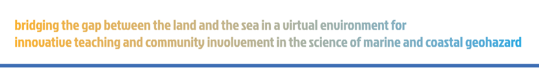
Classroom sessions covered the geology of Santorini, highlighting key geological hazards such as seismic activity, fault ruptures, tsunamis, and landslides. Students also had the opportunity to learn from two distinguished guest speakers, Prof. Beverly Goodman and Prof. Vastis Sahoglu, who shared insights from their research on tsunami waves, based on fieldwork conducted in Santorini and Çeşme - Bağlararası (Türkiye).
Lectures provided an in-depth understanding of the project's scientific and technical aspects, introducing students to various field methods and instruments. These included seabed mapping techniques, Remotely Operated Vehicles (ROVs), Uncrewed Aerial Vehicles (UAVs), and photogrammetry. Special emphasis was placed on the role of Virtual Reality (VR) in enhancing spatial perception of both submarine and coastal landscapes.
FIELDWORK
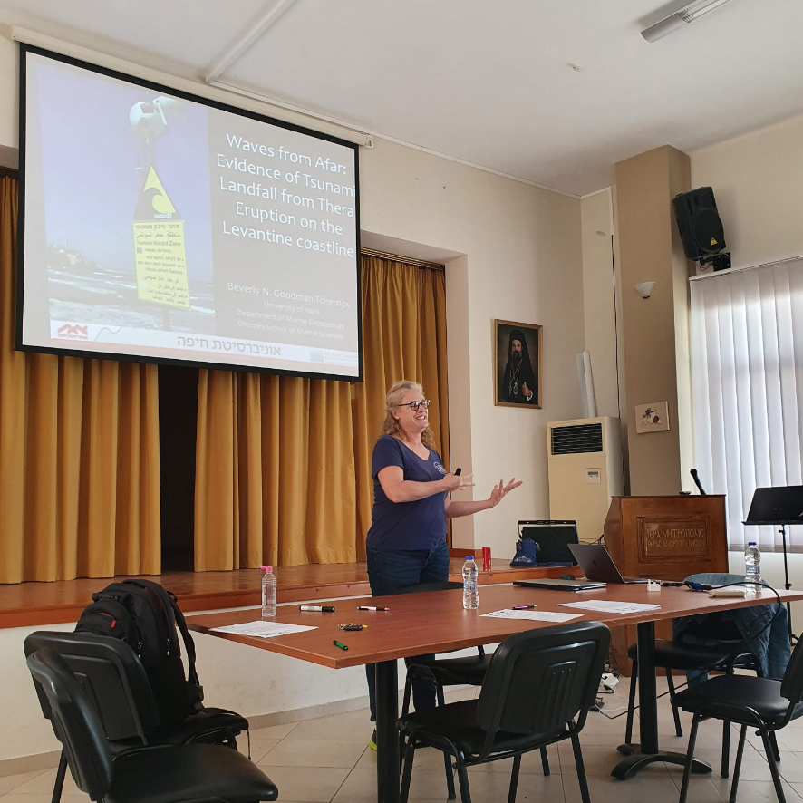
Fieldwork during the Summer School included both geological excursions and hands-on data collection using a variety of specialized equipment.
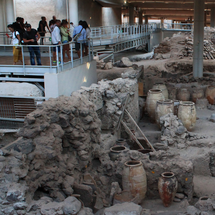
The geological field trips took students to several key locations, including Vlychada Beach, the Metaxa Mine, Red Beach, and the excavations of Akrotiri, as well as the villages of Pyrgos and Oia. In the field, participants engaged in collecting on-land geophysical data, UAS photogrammtric imagery, 360° video footage, and laser scan data. They also observed the process of gathering ground-truthing data at sea using a Remotely Operated Vehicle (ROV).
A full-day boat tour within the caldera allowed participants to closely examine the caldera walls and visit Nea Kameni. They also had the opportunity to explore Thirassia and swim in the hot springs of Palea Kameni, further enhancing their understanding of the region’s geological dynamics.
LABORATORY SESSIONS
Laboratory sessions introduced students to a variety of instruments, with their technical specifications demonstrated in detail. Participants had the opportunity to work with both newly collected datasets from the Summer School and pre-existing datasets provided by project partners.
Students gained hands-on experience with a range of specialized software, including ESRI ArcGIS for spatial analysis, QPS Qimera for processing MBES data, and Agisoft Metashape for applying photogrammetric techniques to terrestrial and underwater imagery. They also worked with CloudCompare to process point clouds generated from UAV and GeoSLAM surveys and used Geopsy for geophysical data analysis.
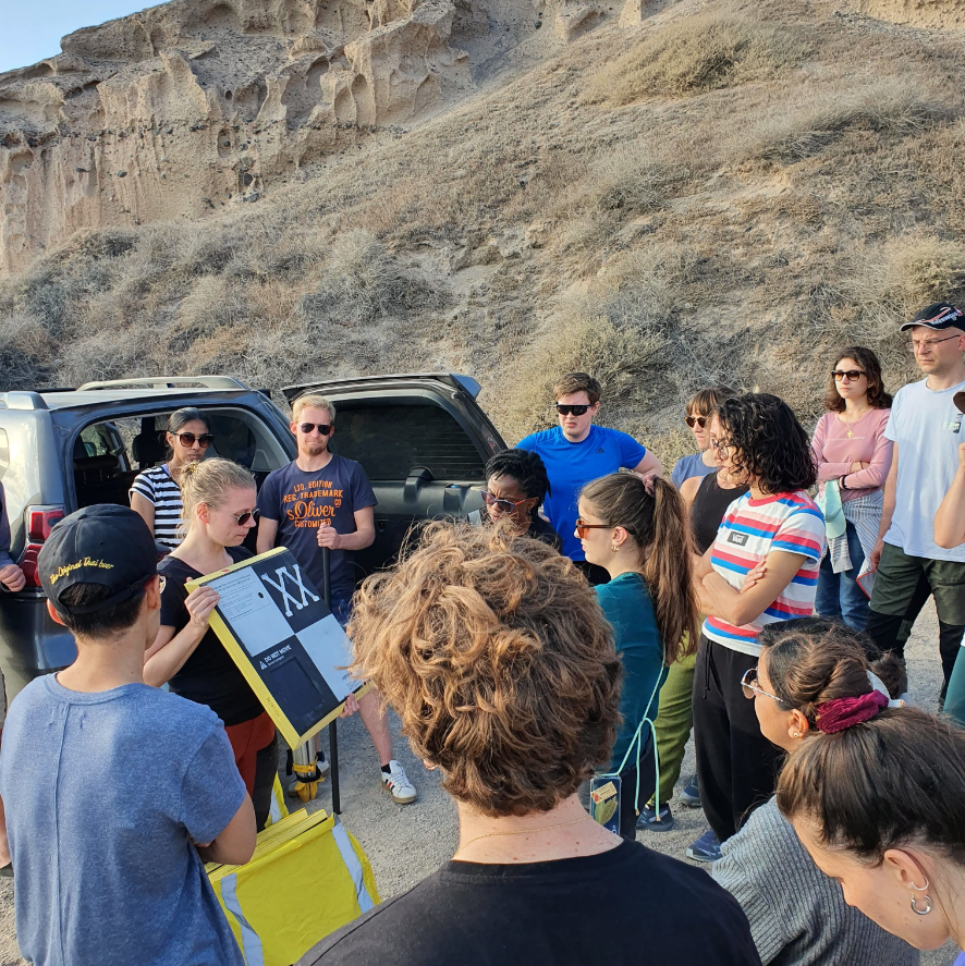
Additionally, access to advanced tools such as Oculus, a 3D PluraView screen, and a 360° camera allowed students to explore natural environments in Virtual Reality (VR). These technologies provided an interactive platform for analyzing terrestrial and underwater landscapes, testing new data collection methods, and enhancing engagement with immersive exploration techniques.
OTHER ACTIVITIES
Through seminars and cultural visits, students explored interdisciplinary topics, gaining a deeper understanding of the interaction between human society and physical processes from both social and economic perspectives. These experiences enhanced their awareness of the significance of marine geosciences and the role of outreach activities in promoting a sustainable future.
Cultural tours included visits to Santorini’s main towns and historical landmarks, such as the Prehistoric Museum of Thira and the excavations of Akrotiri. To immerse themselves in Greek culture, participants enjoyed a traditional dinner at a Caneva in Messaria (Canava Santorini), where the evening concluded with Ouzo and a lively dance session featuring songs from the students' home countries. The program also included a visit to Hatzidakis Winery in Pyrgos, where students learned how local geology and cultural heritage shape the production of unique wines, highlighting the connection between natural landscapes, cultural identity, and sustainable development.